


Bangladesh has long been known as the land of rivers. For centuries, vast networks of waterways flowed across the delta, shaping landscapes, livelihoods, and culture. The Ganges, Brahmaputra, and Meghna systems, along with hundreds of smaller rivers, once spread water, sediment, and nutrients across the country. These rivers were not merely geographical features; they were dynamic systems that defined the ecology and stability of the land itself.
Today, however, the river landscape of Bangladesh has changed dramatically. Many rivers have disappeared entirely due to siltation, encroachment, and changes in upstream flow. Others have been narrowed, filled, diverted, or heavily modified by bridges, embankments, roads, and urban development. Wetlands have been reclaimed for housing and industry. Natural floodplains have been fragmented. These transformations raise an important question: could the degradation of river systems be contributing to increased earthquake vulnerability in Bangladesh?
To answer this question responsibly, we must distinguish between the causes of earthquakes and the factors that influence their impact.
Bangladesh lies in a highly active tectonic zone. The country is positioned near the boundary of the Indian Plate, which is moving northward and colliding with the Eurasian Plate and the Burmese microplate. This immense geological pressure builds deep beneath the Earth’s surface. When accumulated stress is suddenly released, seismic waves travel outward, producing earthquakes. These tectonic movements occur kilometers below ground, far beyond the direct influence of rivers, bridges, or surface development.
Therefore, it is scientifically inaccurate to say that river narrowing or siltation directly causes earthquakes. Earthquakes originate from plate tectonics, not from changes in surface waterways.
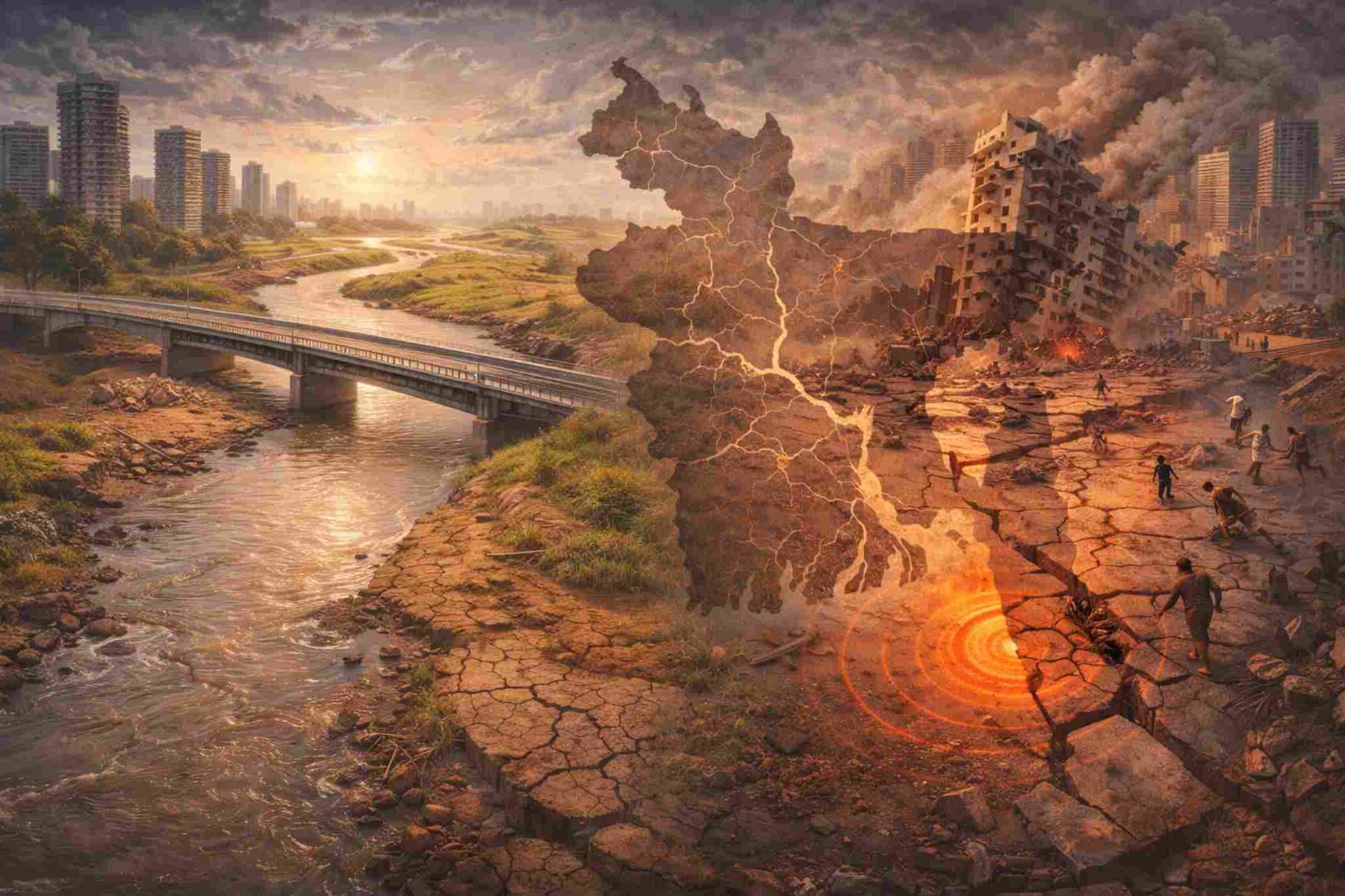
However, while environmental degradation does not create earthquakes, it can significantly increase vulnerability to seismic damage. This distinction is crucial.
Bangladesh’s river systems historically played a stabilizing role in the deltaic environment. Seasonal flooding distributed sediments naturally. Wetlands absorbed excess water. Rivers helped maintain groundwater balance. These processes created a dynamic but resilient landscape.
When rivers disappear or are severely altered, the natural balance of soil and water changes. One of the most significant consequences is soil instability. Much of Bangladesh consists of soft, alluvial soil deposited by rivers over thousands of years. When wetlands and riverbeds are filled for construction, buildings are often erected on loose, unconsolidated sediments. During an earthquake, such soils are prone to liquefaction—a phenomenon in which saturated soil temporarily loses strength and behaves like a liquid under seismic shaking. Structures built on these soils can tilt, sink, or collapse even during moderate tremors.
Urban expansion in cities such as Dhaka, Chattogram, and Sylhet has increasingly taken place over former floodplains and wetlands. These areas were once natural buffers that absorbed water and maintained soil equilibrium. As development encroaches on these spaces, the risk profile changes. Earthquake waves traveling through soft sediments can amplify shaking intensity, making damage more severe in such zones compared to areas built on solid bedrock.
Additionally, excessive groundwater extraction—common in urban centers—can further destabilize soil layers. When groundwater levels drop significantly, the structural integrity of subsurface sediments may weaken. Although this does not cause earthquakes, it can exacerbate ground settlement and increase susceptibility to shaking damage.
Siltation is another factor altering river dynamics. Reduced upstream flow and sediment mismanagement lead to clogged channels and shrinking waterways. As rivers lose depth and width, drainage patterns shift. Flooding becomes more unpredictable. While flooding and earthquakes are separate natural phenomena, weakened land structures from repeated waterlogging can compromise foundations. Infrastructure already stressed by poor drainage may perform poorly during seismic events.
Bridge construction and embankment projects, though essential for connectivity and flood control, also modify natural water flow. If poorly designed or constructed without proper geological assessment, they may contribute to localized instability. The cumulative effect of unplanned development can increase the fragility of the built environment.
It is important to emphasize that Bangladesh has always been seismically vulnerable. Historical records show significant earthquakes in the region long before modern river alterations. The 1762 Arakan earthquake and the 1897 Great Assam earthquake caused widespread destruction across the region. These events were purely tectonic in origin. Thus, current seismic activity cannot be attributed solely to environmental degradation.
However, environmental mismanagement amplifies disaster risk. A moderate earthquake striking a poorly planned urban area built on reclaimed wetlands can cause far greater damage than the same earthquake striking stable terrain with strict building codes.
Climate change adds another layer of complexity. Rising sea levels, increased riverbank erosion, and changing rainfall patterns are altering the delta system. As natural buffers diminish, resilience weakens. Although climate change does not trigger tectonic earthquakes, it increases the overall vulnerability of infrastructure and communities.
Public perception often links environmental destruction directly to natural disasters. While such links are not always scientifically accurate, they reflect a deeper concern about imbalance. When rivers disappear and wetlands vanish, people intuitively feel that nature’s equilibrium has been disturbed. The real issue is not that narrowed rivers are causing earthquakes, but that weakened environmental systems leave society less prepared to withstand natural shocks.
The solution lies in integrated planning.
First, river restoration must become a national priority. Re-excavation of silted rivers, protection against encroachment, and preservation of floodplains can help restore ecological balance. Maintaining natural waterways supports groundwater recharge and soil stability.
Second, urban development must respect geological realities. Construction on former wetlands should require rigorous soil testing and advanced foundation engineering. High-rise buildings in seismic zones must follow strict earthquake-resistant design standards.
Third, disaster preparedness should be strengthened. Public awareness campaigns, emergency response planning, and regular safety drills can reduce casualties when earthquakes occur.
Fourth, infrastructure projects should integrate environmental and seismic assessments from the beginning. Bridges, roads, and embankments must be designed with long-term geological stability in mind.
Bangladesh’s identity as a riverine nation is deeply tied to its resilience. Rivers once carried not only water but also life, fertility, and adaptability. Their degradation represents more than environmental loss; it signals reduced capacity to absorb shocks—whether from floods or earthquakes.
Ultimately, earthquakes in Bangladesh are the result of tectonic forces far beneath the Earth’s surface. Human alteration of rivers does not generate seismic energy. However, environmental degradation increases the fragility of landscapes and structures, magnifying the consequences of natural events.
Recognizing this distinction is essential. Blaming rivers alone oversimplifies the issue. Ignoring environmental vulnerability, however, would be equally dangerous.
A balanced approach acknowledges scientific reality while promoting responsible development. Bangladesh must strengthen both geological preparedness and environmental stewardship. By restoring rivers, protecting wetlands, enforcing building codes, and improving urban planning, the country can reduce seismic risk even if it cannot prevent earthquakes themselves.
The disappearance and narrowing of rivers should serve as a warning, not as a scapegoat. It reminds us that environmental mismanagement compounds vulnerability. The earth may shake due to tectonic movement, but the extent of damage depends largely on how wisely we build and preserve our surroundings.
In the end, resilience comes from harmony between natural systems and human development. Bangladesh’s future safety lies not in attributing earthquakes to river loss, but in rebuilding ecological balance and strengthening structural preparedness. When science, planning, and environmental care work together, the nation can face its seismic challenges with greater confidence and security.


